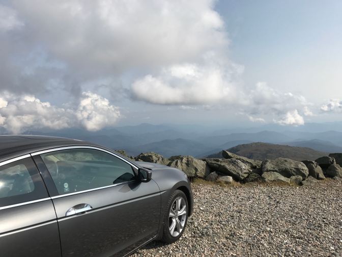
The tallest mountain in the northeastern United States, nestled deep within the White Mountain range with its peak a towering 6,288.2 feet above sea level. A winding, seven-mile long mountain road, and beautiful vistas as far as the eye can see. A 2012 Honda Accord coupe with an appetite for adventure. And a driver who is absolutely terrified of heights. On a beautiful, late summer day, why would I drive up a mountain? In the words of mountaineer George Mallory: “Because it’s there.”
Mt. Washington is the most famous U.S. mountain east of the Mississippi. Native American peoples who lived in the area believed the mountaintop to be the dwelling place of the gods, their name for the mountain was Agiochook (meaning “the place of the Great Spirit”). Although first surveyed by European settlers in the 1640s, the first trail to the top was not established until 1819. Since then, the mountain has become a noted tourist destination, with several hiking trails that lead to its summit (via Wikipedia). The mountaintop also can be reached by the Cog Railway, a “rack railway” that has been bringing people to the summit since 1869 (a rack railway uses a system similar to how a roller coaster is brought to the top of a lift hill- a rack and pinion system keeps the train from rolling out of control down the mountain). Finally, the Mt. Washington Auto Road is a seven-mile long mountainside road that was first built in 1861. More than 45,000 vehicles ascend the road every year, and on Saturday afternoon, with my friend Steve as my navigator and co-pilot, I took DH up, up the mountain ahead.
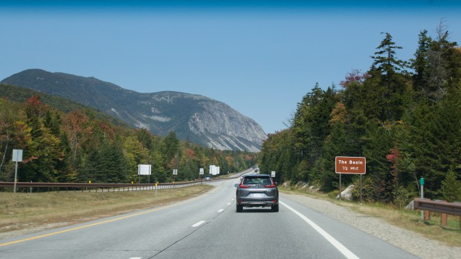
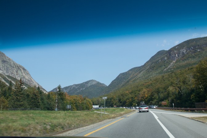
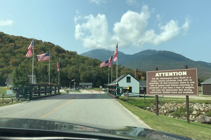
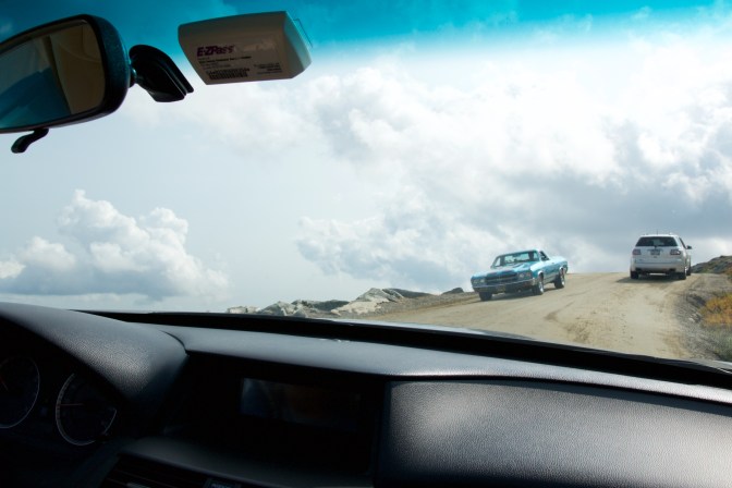
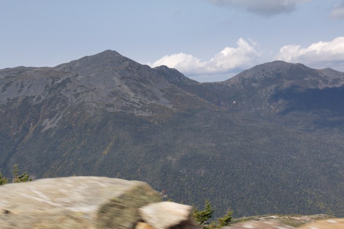
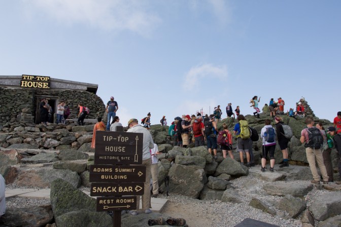
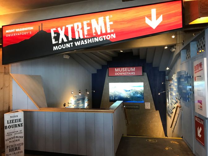
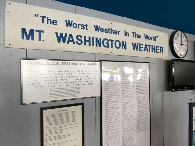
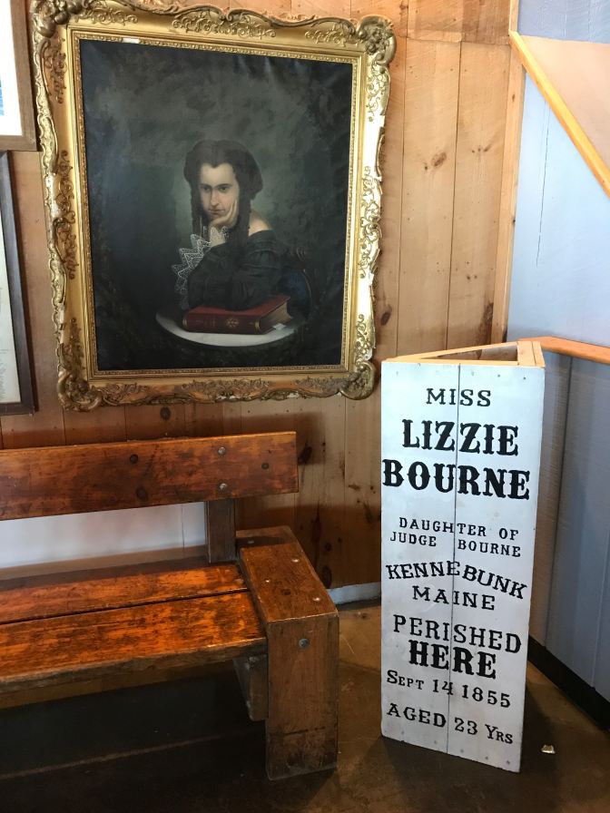
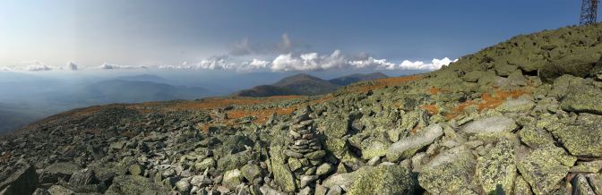
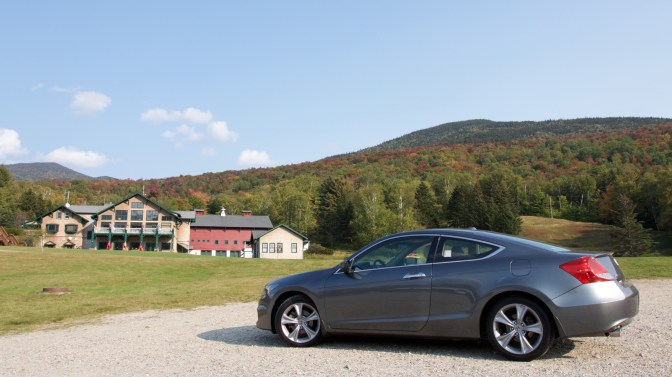
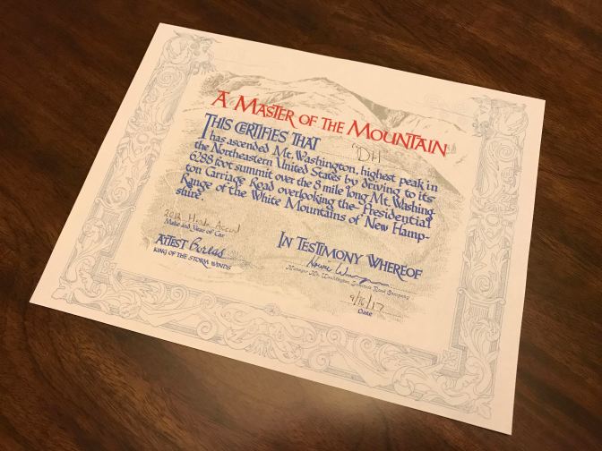
Located deep within the White Mountain range in New Hampshire sits Mt. Washington.Although the forecast called for sunny skies and beautiful weather, the start to the journey was not promising.By the time I picked up my friend Steve from his home in New Hampshire, the skies had begun to clear. As we neared the White Mountains, the weather became absolutely perfect.Our route took us through Franconia Notch, a mountain pass through the western approaches to the White Mountains. Until 2003, this was also the location of a unique rock formation known as “The Old Man of the Mountain,” which resembled the face of a man protruding from the mountainside. Unfortunately, the formation collapsed in 2003. You can still find pictures of it online, however.Arrived!“Attention: The Mt. Washington Auto Road is a steep, narrow mountain road with no guardrails… if you have a fear of heights, you may not appreciate this driving experience.” Gulp.A quick stop at the Visitor’s Center before ascending the mountain.And so we begin. One nice bonus: although it is still summer, the tree leaves are beginning to change color already in the mountains. A special thank you to my friend Steve who did the photography work during the driving shots, freeing me to pay attention to not driving off the side of the mountain.There are numerous turnouts along the road, allowing you to stop and take in the gorgeous scenes unfolding before your eyes.The view was simply amazing. If ever I was glad my iPhone had a panorama feature, it was with this view unfolding before me.The road alternates between paved and gravel sections. One of the challenges is that the road was designed when vehicles were much narrower. Inexperienced drivers tend to cling to the middle of the road, forcing you to move close to the mountain side (where you risk sliding into the drainage ditch that runs along the road) or the cliff side (where you risk simply falling off the road… at least you’ll make it to the bottom quickly). The driver of the El Camino (pictured) descending the road did a good job of staying far to his side, although this is probably one of the wider sections of roadway.A beautiful mountain view. The rock in the foreground marks the road’s edge. Beyond that rock is just air, and a long way to the bottom.Blind curves also mean that inexperienced drivers tend to take the turns very wide, often crossing into the oncoming traffic lane. I drove this road once previously in 2014, and learned very quickly to slow down as I approach these types of curves… you simply can’t predict what other drivers will do when they panic.Made it! We can now add “mountaintop” to the list of destinations DH has visited.To the right, people are lining up to have their photos taken at a cairn marking the summit. To the left is the Tip-Top House, a hotel that is the oldest surviving building atop the mountain (constructed in 1853).Built in 1853 from stones carved from the mountain, the Tip-Top House was originally a hotel. Now a state and national historic site, it allows visitors to imagine spending a night at the summit.The Cog Railway, about to descend the mountain.The Summit House at the top of Mt. Washington was originally a hotel carved from solid granite. Now it functions as a way station for visitors, housing a museum, a canteen, an observatory, and a rest stop for hikers.Mt. Washington is also known for its unpredictable weather. Summit weather is vicious. The highest recorded wind speed in the Northern Hemisphere was recorded here in 1934: 231 miles per hour. In 2004, for a 71-hour period, the temperature never went above -50 degrees Fahrenheit. Snow is not uncommon, even during the summertime.The dangerous weather accounts for many of the 150 fatalities that have been recorded on the mountain since 1849. Lizzie Bourne died from exposure at age 23 in 1855.No nasty weather today, though! Aside from some clouds, temperatures at the top were in the mid-60s and there was no wind to speak of. DH is pictured at the lower left.Crawford Path, the original hiking trail to the summit of Mt. Washington. Today’s journey served two purposes. First, to take the Accord up the Auto Road, but second, to reconnoiter the hiking trails for next summer, when Steve and I intend to summit the mountain by foot. After speaking with some hikers, we identified the Ammonoosuc Ravine trail, which joins up with Crawford Path, as our most probable approach.As I am not an experienced climber, Steve took me down some of Crawford Path so I could see some of the challenges for next year. Once you climb above the tree line, the paths are filled with large rocks, some of which are unstable. Hiking it requires proper gear and careful walking.Needless to say, the view was spectacular.Panorama from the top of Crawford Path.Our time at the summit over, we began the long descent. The view to the left gives you a good idea of what makes this road unique: no guardrail and a pretty quick trip to the bottom of the mountain if you go off the road.The only time in my life when I am standing on the earth and am at the same height as the clouds.Simply spectacular.Despite this very large sign, I immediately saw two guys walking on the vegetation instead of the trail (the vegetation is flatter and easier to walk on than the rocky trails, but doing so destroys the fragile floral and fauna of the alpine zone).Enjoy the beauty, indeed.Goal accomplished! DH, back on level ground. We passed several cars that had broken down, and many others who had cooked their brakes. My advice? On the ride up, turn your air conditioning off and maintain a decent speed to allow proper cooling of the engine. On the way down, leave your car in 1st gear and allow the engine’s power to provide natural braking instead of riding your brakes and cooking them (reducing your stopping power). Only tap your brakes periodically to bleed off some speed. Once you learn to trust the engine braking, the ride down is not nearly as difficult as it seems, and you will preserve your brakes.Obligatory.For dinner, we stopped at Fabyan’s Restaurant, part of the Mt. Washington Resort in Bretton Woods. Originally a railroad station, the restaurant serves great food and a good selection of local brews. My cheeseburger was fantastic, and if you like beer, I would highly recommend the Moat Mountain Hell Yes! Helles Lager.This charming restaurant retains many of the architectural features of its train station past, including the ticket booth (center).I was going to place my name on the certificate of achievement, but it felt more appropriate to give DH full credit- the Accord did a wonderful job today, making the climb up the mountain a breeze.
The only thing I wish I had done differently was to have purchased a GoPro camera and filmed a time-lapse video of the drive to the summit. Instead, I thought I would share this footage of rally driver David Higgins’ record-setting race to the top of the mountain in 2011 for Subaru Rally Team USA. His run to the top begins at the 3:16 mark.
The Mt. Washington Auto Road is the most exciting drive I have ever done, the only experience that approached it for excitement and terror being a drive through the Alps in Europe with my friend Jason several years ago. The Auto Road opens in late May and closes in late October, although weather conditions can close the road at any time, so you should call ahead to check on road status before heading there. It costs $29 for a car and driver, and $9 for each additional adult ($7 for each child, although children under 5 are free). For those of you who would prefer not to drive the road yourself, the Mt. Washington Auto Road also offers guided shuttles to the summit, if you would like to sit back and leave the driving to someone else. A second thank you to my friend Steve for his co-piloting skills as well as his help with the photography on this trip. And thank you for coming along on another journey down The Open Road Ahead!
Awesome! This reminds me of the Mount Evans, Colorado drive I took a couple of years ago. Love being able to see so far in the distance – even if it means dealing with a few gut-wrenching miles without a guard rail. Pretty cool that DH even got a paper certificate too. Great trip! Adding it to my must-see list.


I went there when I was a child and wanted to take the kids there. Maybe next summer! Yea looks great! Nancy
LikeLike
It’s a great trip- and I think the girls would love it!
LikeLike
Awesome! This reminds me of the Mount Evans, Colorado drive I took a couple of years ago. Love being able to see so far in the distance – even if it means dealing with a few gut-wrenching miles without a guard rail. Pretty cool that DH even got a paper certificate too. Great trip! Adding it to my must-see list.
LikeLiked by 1 person
Thanks Tyson! It was maybe the single best road trip I’ve done with the Accord- you’d love this drive.
LikeLike